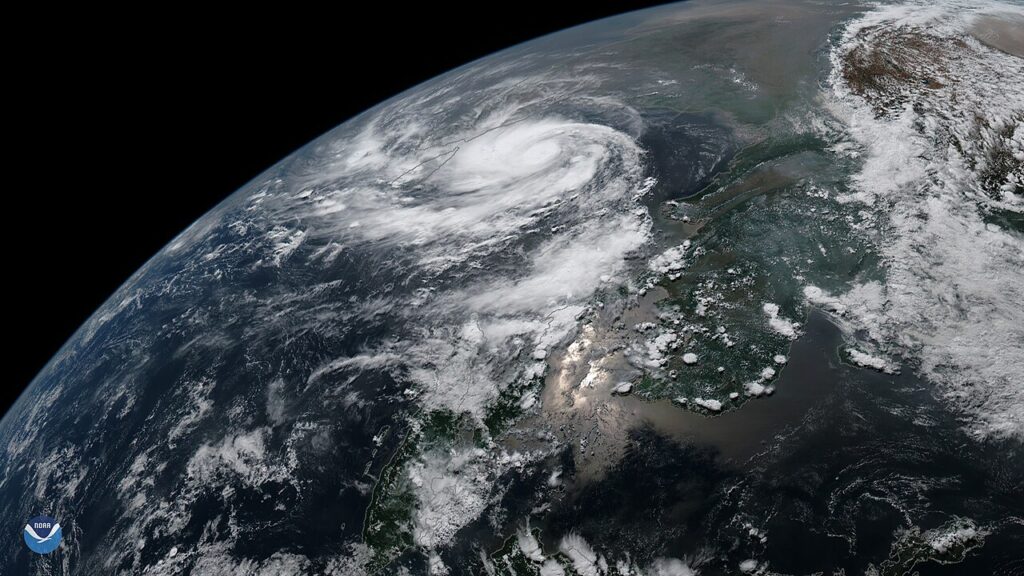
Informopedia Explains: on the night of November 12, 1970, the sea came inland in what is now Bangladesh and did not stop. A cyclone’s storm surge — a wall of ocean water driven ashore by the storm’s winds — swept over flat, low-lying islands in the dark, on top of a high tide. By morning, entire villages were gone. An estimated 300,000 to 500,000 people were dead, making the Bhola cyclone the deadliest tropical cyclone in recorded history. More than half a century later, the same bay is making headlines again, with a storm heading for India’s Odisha coast on October 28. So what is it about this one stretch of water that makes it so lethal — and why are its storms killing far fewer people today?
A bay shaped like a funnel
Start with geography. The Bay of Bengal is a triangle, wide at the bottom where it meets the Indian Ocean and narrowing to a point at the top, where the coasts of India and Bangladesh meet. When a cyclone moves north into that narrowing shape, the water it pushes ahead of itself has nowhere to spread. It piles up, higher and higher, like water forced through the neck of a funnel. The northern end of the bay is also shallow, which lets the surge build further instead of dispersing into deep water. Add the bay’s many small inlets and river mouths — water forced into each one floods the land beside it — and a storm surge that might be a few metres on an open coast can reach 10 metres here. Bhola’s surge was measured at up to 10.4 metres.
Then add the land itself. The coasts around the northern bay are almost flat, barely above sea level, and densely farmed. Millions of people live within a few metres of sea level because the soil is fertile and the rivers bring life. When the surge comes, there is no high ground to run to, and in 1970 there were few shelters and few warnings that reached the islands in time.
Warm water, twice a year
The bay also breeds storms with unusual efficiency. Cyclones need warm surface water — roughly 26.5°C or more — and humid air, and the Bay of Bengal offers both, twice a year. Sea temperatures there sit around 28–31°C, and light winds around the bay keep the surface warm instead of mixing cooler water up from below. Storms form most readily before the monsoon (April–June) and after it (October–December), which is why the calendar of Bay of Bengal disasters clusters in those windows. The storm now heading for Odisha is a classic post-monsoon system.
The statistics that follow are grim. The bay covers just 0.6% of the world’s ocean area, yet it is estimated to be responsible for four out of five cyclone-related deaths in history; eight of the ten deadliest cyclones on record formed there. After Bhola came the 1991 Bangladesh cyclone, with winds of 155 mph and a surge of about 20 feet, killing nearly 140,000 people. In 2008, Cyclone Nargis pushed a surge of more than 10 feet up Myanmar’s Irrawaddy Delta and killed an estimated 138,000.
So why are the death tolls falling?
Here is the genuinely hopeful part of the story. Odisha itself lost more than 10,000 people to a super cyclone in 1999. Since then, death tolls from Bay of Bengal cyclones have mostly fallen to double figures. The mortality rate associated with cyclones in the region dropped by almost 88% in 2010–2019 compared with the previous decade. Three things changed.
First, forecasting got dramatically better. India’s weather office can now track a storm days out and predict its landfall within a narrowing cone — the October 28 forecast was issued four days ahead. Satellites, run by India’s space agency ISRO among others, are now the primary tool for watching these storms form.
Second, governments learned to move people, not just warn them. Odisha’s “zero casualty” policy means mass evacuation to cyclone shelters, stocked in advance, with special attention to pregnant women, children and the elderly. When a state can empty a coastline before landfall, a storm’s winds can destroy houses without filling graveyards.
Third, the shelters themselves. Thousands of purpose-built cyclone shelters now dot the coasts of Odisha and Bangladesh, alongside raised embankments and early-warning systems that reach villages by phone and loudspeaker, not just by radio bulletin.
Why this matters — and what comes next
None of this means the danger is over. Sea-level rise is slowly raising the baseline on which every future surge will ride, which means the same storm will flood further inland in 2050 than it did in 1970. Warmer seas can also, in principle, fuel stronger storms, though scientists are careful to note that the link between warming and any single storm’s strength is not simple. And the system only works if people trust the warning and leave: a perfect forecast is useless if a family stays to guard livestock or a fishing boat.
The storm approaching Odisha this week is the latest test of a system built from the worst disaster in cyclone history. If the forecast holds and the evacuations work, it will pass as a story about wind, rain and damaged roofs. That unremarkable outcome — a dangerous storm that kills almost nobody — is the real measure of how far the Bay of Bengal has come since the night the sea came inland.
Internal links: how Super Typhoon Champi’s eyewall came ashore on Guam; Hurricane Trudy’s path and warnings. Outbound: India Meteorological Department (IMD).