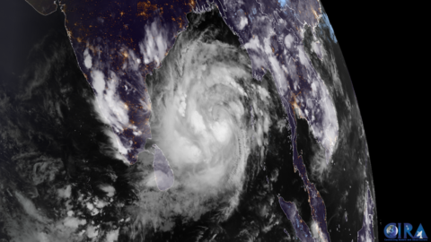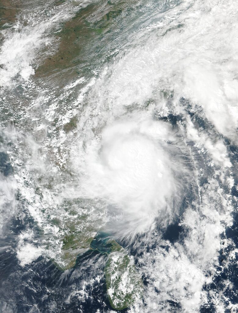
Severe Cyclone Murasu began crossing India’s eastern coast in the early hours of Tuesday, bringing winds of 100 to 110 kilometres per hour to the southern coast of Andhra Pradesh and forcing thousands of people from low-lying villages into shelters.
India’s weather department, the India Meteorological Department (IMD), said the landfall process began at 1 a.m. local time on Tuesday, November 3. Landfall is not a single moment: it is the hours-long process during which the storm’s centre moves from sea to land, and the IMD expected it to be complete by about 4 a.m., with the crossing taking place between Nellore and Narsapur, close to the town of Ongole in Prakasam district.
At 11:30 p.m. on Monday, the storm’s centre was about 50 kilometres south-east of Ongole, and its outer rain bands had already reached the coast. The IMD advised people in the affected areas to stay indoors while the crossing was under way.
Andhra Pradesh officials had begun moving people out of vulnerable coastal areas on Monday. About 2,000 people had already been evacuated, and the state planned to move around 30,000 in total. “Around 2,000 people have been evacuated, and the process is continuing. We are planning to evacuate some 30,000 people,” Prakhar Jain, managing director of the Andhra Pradesh State Disaster Management Authority, told Reuters on Monday.
The IMD has warned of extremely heavy rainfall over coastal Andhra Pradesh on November 2 and 3, with very heavy rain also possible in the inland Rayalaseema region and in neighbouring Tamil Nadu to the south. A storm surge of 1 to 1.5 metres above the normal tide could flood low-lying pockets of the coast, particularly around Bapatla, Krishna and Prakasam districts. Red alerts — the highest level of warning — were in force for Krishna, Guntur, Bapatla, Prakasam and Nellore districts, and 12 teams from the national and state disaster response forces were positioned along the coast. Fishing and shipping off the Andhra coast were suspended until Tuesday afternoon.
No casualties or damage figures had been confirmed at the time of publication. That is normal at this stage: the worst winds arrive with the storm’s centre, and a full picture of flooding and damage only emerges after daylight, once survey teams can reach affected areas.
Murasu is the second cyclone to hit this stretch of coast in less than a week. Cyclone Arnab struck the same region on October 28, killing six people and destroying dozens of houses and crops. Communities that were still clearing up after Arnab are now facing a second storm before repairs are finished — a pattern that stretches shelters, relief supplies and the patience of people who have already been evacuated once.
The Bay of Bengal, the sea between India and South-East Asia where Murasu formed, has produced some of the deadliest storms on record, because its shallow, funnel-shaped northern end pushes surge water far inland. That geography is why evacuation numbers matter as much as wind speeds: most cyclone deaths in this region come from water — surge and flooding — rather than wind alone.
Why this matters beyond India: back-to-back cyclones are a test of a system the whole world watches. Early-warning satellites, evacuation plans and shelter networks are the reason storms that once killed tens of thousands in this region now kill far fewer — but only when warnings reach the last village and people trust them enough to leave. Murasu’s landfall, days after Arnab, will show whether that system holds up when it has to work twice in one week. It will also be watched by insurers, aid agencies and governments across South and South-East Asia, where the same Bay of Bengal storm season threatens Bangladesh, Myanmar and Sri Lanka as well.
Further updates, including any confirmed casualty or damage figures and the IMD’s post-landfall bulletin, will follow as they are verified.
Related coverage: Cyclone Murasu Strengthens on Its Way to India’s Andhra Coast — Landfall Expected Tonight and Cyclone Arnab Slams Into India’s Andhra Coast With 150 kmph Gusts. The India Meteorological Department’s official updates are published at mausam.imd.gov.in.