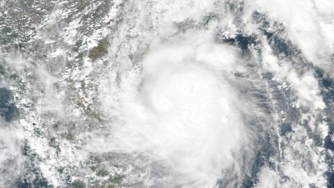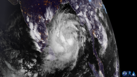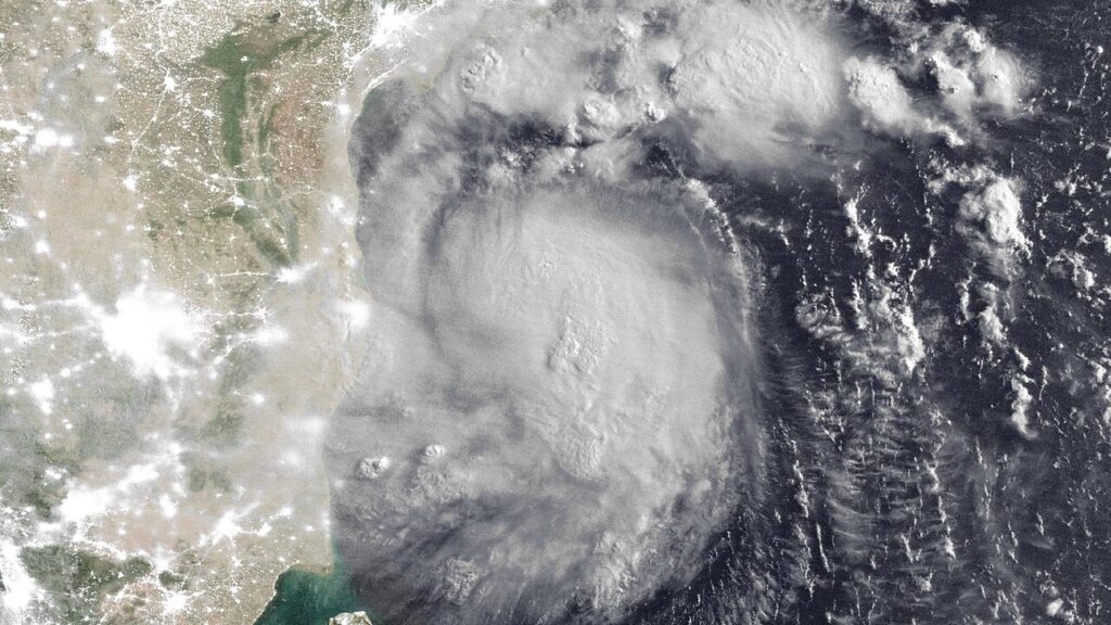
Severe Cyclonic Storm Murasu has finished crossing India’s south-eastern coast, the country’s government weather agency said on Tuesday, closing a landfall that began in the early hours of the morning and put the state of Andhra Pradesh on red alert for the second time in a week.
The India Meteorological Department (IMD) said the storm crossed the south Andhra Pradesh coast between Nellore and Narsapur, close to the city of Ongole, between 3:30 and 5:30 a.m. local time, with sustained winds of 100 to 110 kilometres per hour and gusts reaching 120. The centre of the storm was fixed near latitude 15.53°N and longitude 80.22°E as it came ashore.
The landfall began at about 1 a.m., when the storm’s inner rain bands moved onto the coast. By around 5 a.m., most of its wall cloud — the ring of fiercest wind and rain around the eye — was already over land, and the eye itself was entering the coast.
Prakhar Jain, managing director of the Andhra Pradesh State Disaster Management Authority, told Reuters: “No deaths or injuries have been reported so far.” Some trees and electric poles were uprooted, he said, but no casualties had been confirmed by Tuesday morning.
Authorities had planned to move about 30,000 people to safety from vulnerable shoreline communities, and around 2,000 had already been evacuated by Monday, Jain told Reuters. Three National Disaster Response Force teams were moved into the coastal districts, and state response units were deployed across Krishna, Bapatla, Guntur, Nellore, Prakasam, Palnadu and Tirupati.
The disruption spread quickly. IndiGo cancelled eight flights from Vijayawada, South Central Railway cancelled selected services and opened a round-the-clock war room, and heavy rain left roads waterlogged in Vijayawada, according to the news agency ANI. The IMD had warned of a storm surge of 1.0 to 1.5 metres above the normal tide over low-lying parts of the south Andhra coast, with the highest surge expected over Bapatla, Krishna and Prakasam districts.
Murasu is the second cyclone to strike this coastline in about a week. It strengthened over the Bay of Bengal over the weekend, days after Cyclone Arnab, classified as a very severe cyclonic storm, made landfall in Andhra Pradesh last Wednesday and killed at least six people. Soils were already saturated, and in places repair work from Arnab had barely begun when the new warnings went out.
What happens next is now about water, not wind. The IMD expects Murasu to weaken over land, dropping to a cyclonic storm through Tuesday and a deep depression later, while its rain bands push inland into Telangana and the Rayalaseema region. Heavy rain is forecast along the south Andhra coast for the next 12 hours, and fishermen have been told to stay off the sea until the afternoon of November 4. The state disaster helpline is 1070, and officials are still advising people in affected areas to stay indoors.
Why this matters: a landfall with no deaths reported is not the same as a storm that did no harm. The toll from a cyclone is often counted in the hours after the wind drops — in flooded roads, fallen power lines and homes damaged by surge water — and a second storm in seven days stretches the same rescue teams, shelters and repair crews twice. That Andhra Pradesh got 30,000 people out of the way before the centre crossed is the reason the first reports read as they do. Whether that record holds will depend on the inland rain, and on how fast damage teams can reach the villages that spent the night without power.