Informopedia Explains: on the morning of December 26, 2004, the seafloor off the Indonesian island of Sumatra moved — and a few hours later, people were dying on beaches in Somalia, seven hours’ travel time away.
The earthquake measured magnitude 9.1. It ruptured some 1,300 kilometres of seafloor along the Sunda Trench, lifting the seabed by up to five metres. The waves it launched killed more than 227,000 people in fourteen countries. And the Indian Ocean had no tsunami warning system at all. The lesson of that day is still the foundation of everything we know about tsunamis — including why some earthquakes, even very large ones, make no wave worth fearing.
It is not a wave. It is the whole ocean, moved.
A tsunami is not a giant version of an ordinary wave. Ordinary waves are made by wind, and they move only the top few metres of water. A tsunami is made by the seafloor itself moving, and it moves the entire column of water above it — often four to six kilometres deep.
The mechanism starts at a subduction zone, where one tectonic plate is being forced beneath another. Friction locks the boundary for decades or centuries while strain builds up. The overriding plate is dragged downward, bent like a drawn bow. Then, in seconds, the lock breaks. The plate snaps upward and seaward by several metres, over an area hundreds of kilometres long. The water above it has nowhere to go but up — and where the plate is being dragged down, the seafloor drops, and the water sinks with it. The result is a broad mound on the ocean surface, matched by a trough, more than a hundred kilometres wide but only a metre or two high.
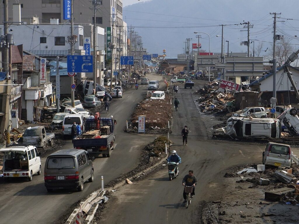
Gravity pulls the mound back down. That collapse launches waves in both directions, travelling at the speed of the square root of gravity times depth — about 713 kilometres per hour over water 4,000 metres deep, as fast as a jet aircraft. In the open ocean, a ship would barely notice the wave passing beneath it. But as the wave reaches shallow water it slows down, and all that energy has to go somewhere: the wave grows taller and taller. In 2011, the tsunami that struck Japan’s Sanriku coast ran up to about 40 metres high.
Four conditions — and the quakes that fail them
Not every submarine earthquake makes a tsunami. Four conditions generally have to be met. The quake must be large — usually magnitude 7.5 or greater, though smaller ones can trigger local tsunamis through submarine landslides. It must be shallow, less than about 70 kilometres deep, so the rupture displaces the seafloor rather than breaking deep inside the Earth. It must happen beneath the ocean. And, most importantly, the fault must move vertically.
That last condition is why the type of fault matters more than the size of the quake. Thrust faults at subduction zones, where one plate dives under another, are the most efficient tsunami generators on Earth: their slip is almost entirely vertical. Strike-slip faults, where plates grind past each other sideways, move very little water. The 1906 San Francisco earthquake measured magnitude 7.9 and ruptured partly offshore — but the San Andreas Fault moved horizontally, and the tsunami it produced was minimal.
This is also why the numbers on a news report can mislead. When the Flores earthquake struck Indonesia in October 2026 at magnitude 7.7, a tsunami warning was issued and then lifted after a wave of just 1.61 metres was measured at Riung. When the Panama earthquake of the same month hit magnitude 7.7, warnings went out immediately. Magnitude alone never answers the question. Depth, location and — above all — direction of movement do.
The sea that disappears — and the sea that doesn’t
Every tsunami safety poster shows the same warning sign: the sea suddenly draining away from the beach, exposing the seafloor, before the wave arrives. It is real — but it is only half the story, and believing it too literally has killed people.
When a megathrust ruptures, one side of the fault is pushed up and the other is dragged down. Coasts facing the lowered side see the water drop first. Coasts facing the raised side are hit by rising water with no warning drawback at all. The 2004 disaster showed both: in Thailand, east of the rupture, the sea withdrew dramatically before the first wave; in Sri Lanka and India, to the west, the first sign for many places was the water rising. The rule that saves lives is simpler than the poster: if the ground shakes strongly for 20 seconds or more near the coast, move to high ground immediately. Do not wait to see what the sea does, and do not wait for an official warning.
Earthquakes cause most tsunamis, but anything that suddenly displaces a large volume of water can do it. Submarine landslides are the second great cause. Volcanic eruptions are the third: the 1883 eruption of Krakatau sent waves across the Indian Ocean, and the Hunga Tonga eruption of 2022 did the same across the Pacific. Even so, more than 90 percent of the largest earthquakes — and virtually all major tsunamis — come from subduction zones.
The buoys that listen to the deep
The 2004 disaster exposed a brutal fact: the Pacific had a warning system, the Indian Ocean did not. The Pacific Tsunami Warning Center had been operating from Hawaii since 1949, set up after a 1946 Aleutian Islands tsunami killed 159 people in Hawaii, 96 of them in Hilo. After 2004, regional warning networks were built for the Indian Ocean, the Caribbean and the Mediterranean.
The backbone of the modern system is a device with an unglamorous name: DART, the Deep-ocean Assessment and Reporting of Tsunamis. Each station is a pressure sensor anchored on the seafloor at depths of 1,000 to 6,000 metres, able to detect a change in sea level of about one millimetre at 6,000 metres down. When it senses a tsunami-like signal, it sends the data by acoustic modem to a surface buoy, which relays it by satellite to the warning centres. Within minutes of a large quake, centres like the Pacific Tsunami Warning Center and the Japan Meteorological Agency estimate its location, depth and magnitude and issue their first alerts.
Before DART, many warnings were false alarms — and false alarms teach people to ignore the real ones. The buoys changed that: forecasters can now confirm a wave exists in the open ocean, hours before it reaches land, and estimate its arrival time at distant coastlines within minutes.
What we still cannot do
Detection has improved beyond recognition since 2004. Prediction has not. Seismologists still cannot say when the next major megathrust rupture will happen, or how large it will be. The largest instrumentally recorded earthquake remains the 1960 Valdivia quake in Chile, at around magnitude 9.5, whose tsunami crossed the entire Pacific. The subduction zones that produced 2004 and 2011 are still locked, still accumulating strain, and will rupture again on a timescale of centuries — a timescale no warning system can shorten.
That is the honest limit of the science, and it is why the 2004 lesson matters more than any sensor. Tsunamis are rare, fast, and indifferent to borders: a wave born off Sumatra killed people in Somalia. The defence is not prediction. It is knowledge — knowing what a long, strong shake near the coast means, knowing that the first wave may not be the largest, knowing to stay on high ground until the all-clear — and a warning system that tells the truth quickly. In 2004, the ocean moved and nobody was listening. Now, at least, the buoys are.
Why this matters: Hundreds of millions of people live along tsunami-vulnerable coastlines, most of them around the Pacific Ring of Fire, where roughly three-quarters of all tsunamis occur. The same physics that made the 2004 wave also explains why scientists still can’t predict earthquakes — the strain builds silently for centuries and releases in seconds. Understanding the mechanism is not academic. It is the difference between running uphill and walking down to the beach to look at the strange, empty seafloor.
Learn the warning signs for your own coastline: NOAA’s Tsunami Program explains the alerts, the zones at risk and what to do when one sounds.