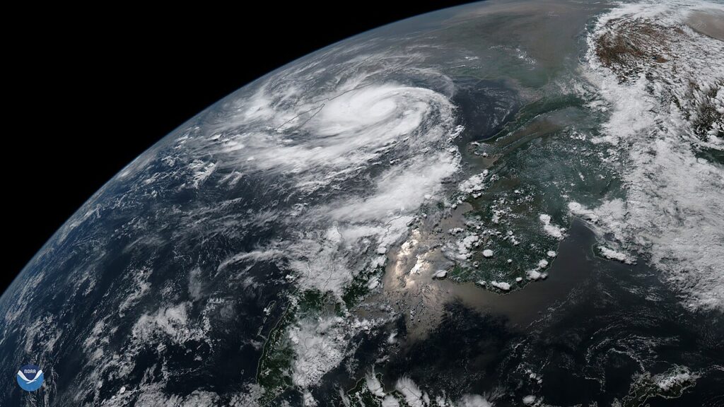
The Bay of Bengal is brewing its third cyclone in about a month. A deep depression over the southeast Bay of Bengal is expected to strengthen into a cyclonic storm by this evening — when it will be named Cyclone Akvan — and then keep strengthening into a severe cyclonic storm by Tuesday, November 17. India’s weather office says it is likely to reach the Andhra Pradesh coast around the night of November 19 as a very severe cyclonic storm.
The system began as a low-pressure area over the southeast Bay of Bengal, became a depression on Sunday morning, November 15, and has been gathering strength as it moves north-northwestwards. As of late Sunday it was a deep depression, with winds of 45 to 55 kilometres per hour gusting to 65. The India Meteorological Department (IMD) expects winds to reach 60 to 70 kmph gusting to 80 by this afternoon, and 90 to 100 kmph gusting to 120 by Tuesday evening.
Akvan — a name contributed by Iran to the regional list of cyclone names — is the third system to form in the Bay in roughly four weeks, after two successive cyclones hit the region in recent weeks. November is the most active month of the post-monsoon cyclone season in the north Indian Ocean, and this year is living up to the pattern.
Who is in the path
The immediate concern is rain. Coastal Andhra Pradesh is likely to see heavy rainfall on November 18, followed by heavy to very heavy rainfall on November 19 and 20. Odisha is bracing for heavy rain from November 19, and Tamil Nadu and the Andaman and Nicobar Islands are also in line for heavy showers. Sri Lanka’s weather office reported the system about 640 kilometres northeast of Trincomalee late on Sunday, moving away from the island — but keeping a close watch all the same.
Bangladesh’s sea ports — Chattogram, Cox’s Bazar, Mongla and Payra — have been told to keep distant cautionary signal No. 1 hoisted, with squally weather possible along the coast. No direct hit on Bangladesh is forecast, but fishermen have been warned to stay alert as sea conditions deteriorate.
The IMD’s forecast track takes the storm northwestwards toward the Andhra coast over the next two days, with further intensification possible after it becomes a severe cyclonic storm. Landfall details — the exact place and hour — will sharpen as the storm gets closer, and the next two bulletins will matter more than this one.
A season that keeps coming
The Bay of Bengal has a particular cruelty: its shallow, warm waters and funnel-shaped coastline turn cyclones into storm surges that can push seawater kilometres inland. The region’s disaster agencies have learned the hard way — through storms like Simon off Mexico and Trudy bearing down on the same coast — that the hours between a forecast and a landfall are when lives are saved, by evacuation orders issued early and heeded. Andhra Pradesh and Odisha have some of the best cyclone evacuation systems in the world, built from the wreckage of the 1999 super cyclone that killed around 10,000 people in Odisha.
Whether Akvan tests that system depends on the next 72 hours. For now, it is a deep depression with a name waiting for it — and a coastline watching the sea.